Steer your next well with Simplesteer.
The geosteering workbench that lives in your browser. Interpret, correlate, and steer live wells from any device — no install, no licence dance, no bill until the bit turns.
- Free forever for clients
- No credit card
- $0 between wells
- Data hosted in Canada
Short, silent videos of the real workbench — learn it in the order you'll meet it.
Watch the tutorialsDifferentiators
Faster than the software it replaces. Yes, in a browser.
Simplesteer renders on the GPU. Full-resolution curves, field-scale grids, dozens of offsets — more data on screen than the desktop packages it replaces, at 60 fps, in a browser tab. Built for rig internet — ~50 KB/s per live well — with edits that land instantly and reconcile in the background. Close the tab at crew change; it reopens exactly where you left it.
RECEIPTS → V-06 big-file import · V-04 basin pan
The workbench, panel by panel.
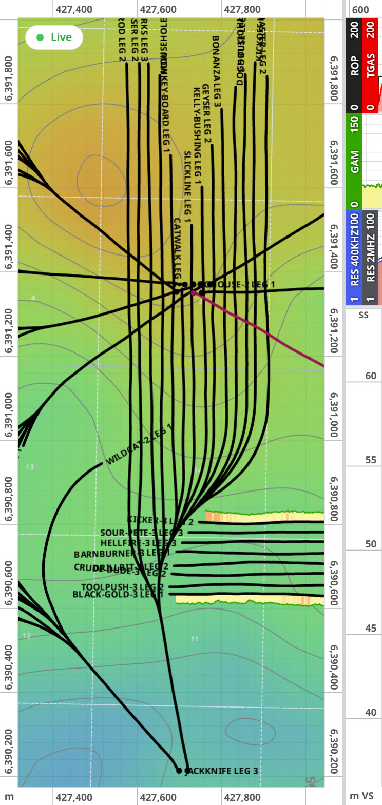
Map
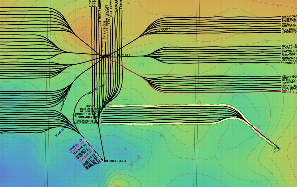
· Plan view · GPU canvasYour whole basin on one GPU canvas — wellheads, laterals, grids, contours, heatmaps. Pan it like a web map, because it behaves like one.
- Thousands of trajectories, smooth at 60 fps
- Structural grids with contours; swap palettes live
- Drag a target waypoint in plan view — the section follows in the same frame
- Flip to 3D — legs, targets, and offsets in space
RECEIPTS → V-04 basin pan · V-09 select anywhere
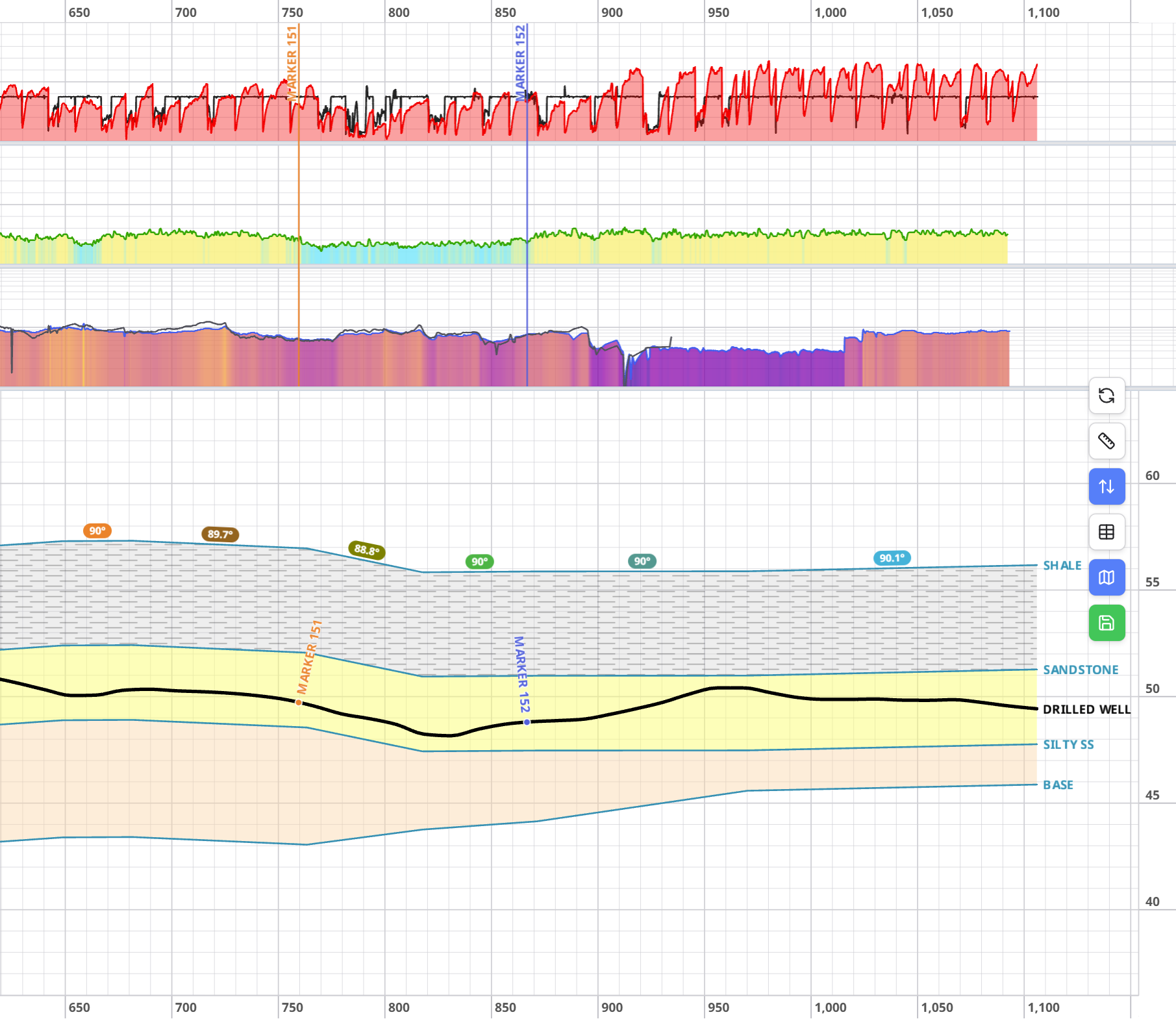
Cross-section
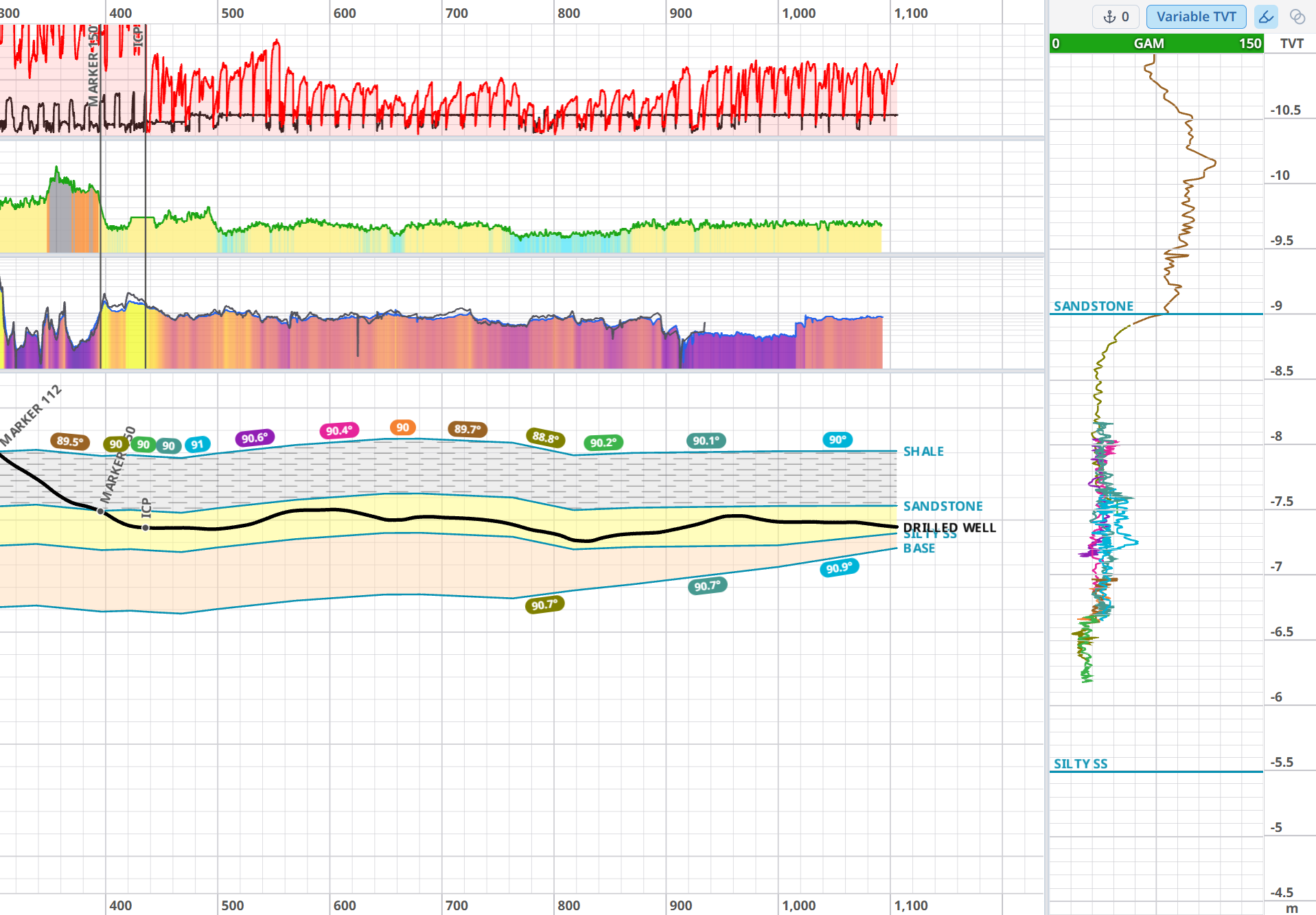
· The steering cockpitHorizons ride the live trajectory — drag a knot, read the dip, keep the bit in zone while the rig streams.
- Two-click target lines — reshape by dragging, or type exact numbers
- TVT panel beside the section — steer in thickness space
- True multilaterals: legs, tie-ins, sidetracks without contortions
- Offset wells on one section; vertical exaggeration that makes structure jump
RECEIPTS → V-01 target line · V-02 steer the lateral · V-05 vertical exaggeration

Correlation
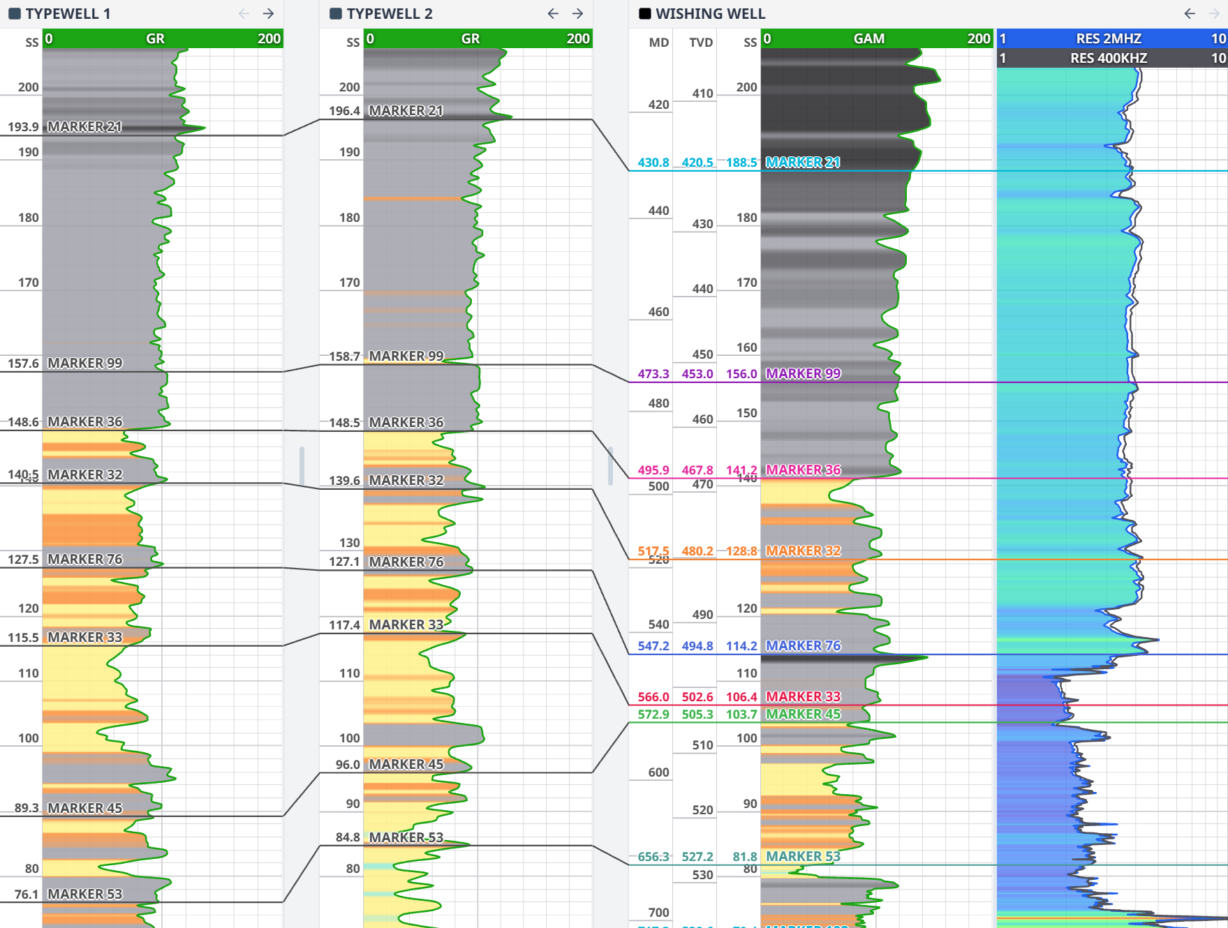
· Every offset, one dragGamma, resistivity, sonic across every offset. Correlate with a single drag — picks snap to the log feature, not to your tired hand.
- Markers snap to the nearest zero-crossing
- Multiple tracks per well; reorder wells by dragging columns
- Tops sync everywhere — correlation, map, section, grids
RECEIPTS → V-03 pick across wells
Analytics & gas
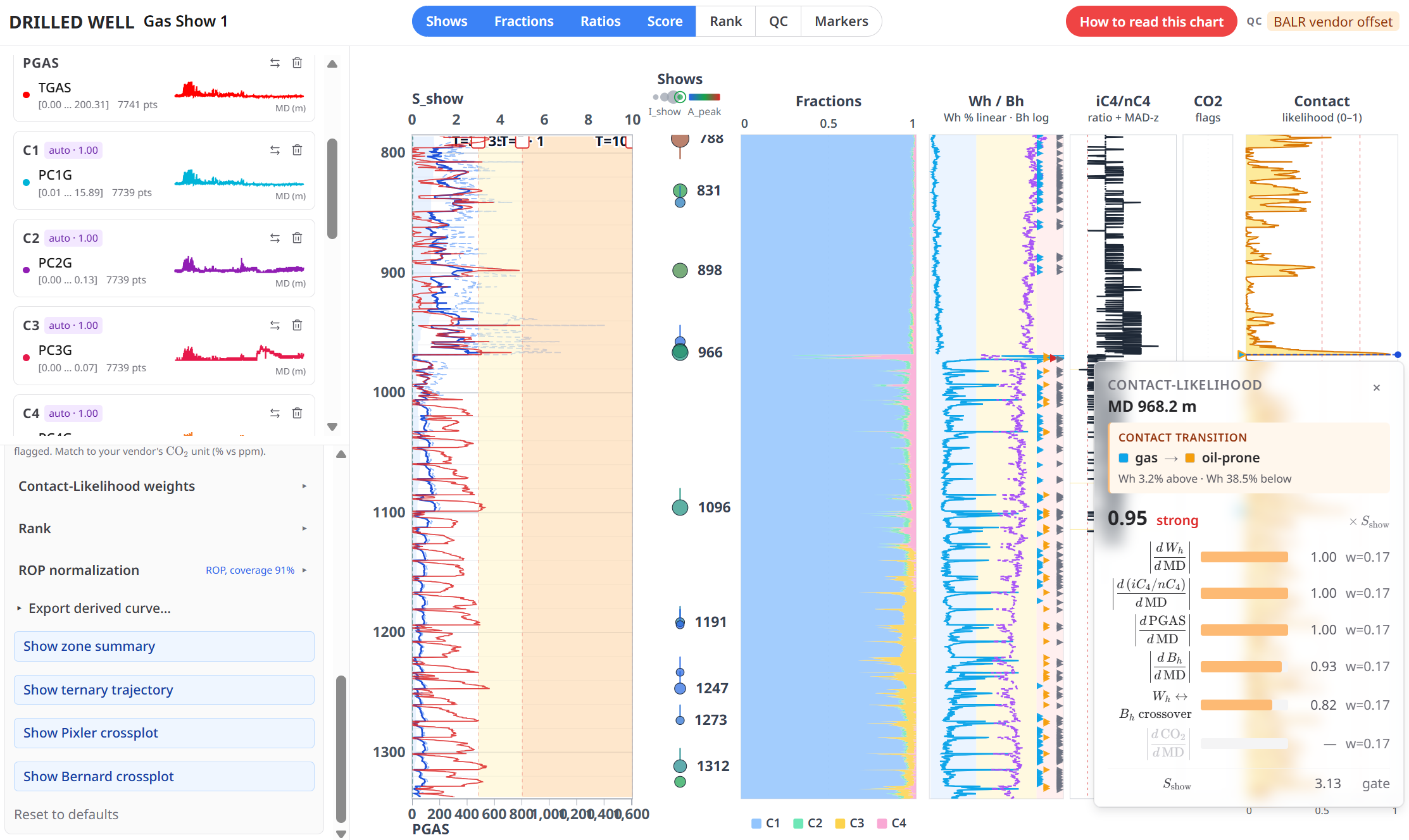
· Petrophysics & mud gas, liveHistograms, 2-D cutoffs, K-means facies, and a full mud-gas suite — beside the live section, not in next month’s study.
- Net/pay from a draggable 2-D cutoff — numbers update as you drag
- K-means / PCA facies pushed back onto the section as colour
- Gas suite: wetness/balance/character, ternary, Bernard, Pixler, zone scoring
- Calculated logs from a formula bar — derive curves without exporting
RECEIPTS → V-08 cutoff drag · V-10 gas ternary
The science belongs at the bit.
Drilling went real-time twenty years ago. The geoscience mostly didn’t — correlation in one tool, petrophysics in another, gas in a spreadsheet, and the steering screen showing gamma alone. Simplesteer puts the whole kit — correlation, cutoffs, facies clustering, mud-gas geochemistry — beside the live section. The 3 a.m. steering call gets the same rigour as the post-well review.
Wellsite & remote geologists
Steer from the rig, the office, or the kitchen table. The well looks the same everywhere.
Geosteering consultants
Every client, every live well, in one browser tab. Software that bills like you do: by the drilling day, straight onto the AFE.
Operators & drilling engineers
Watch every lateral live without buying seats. The data stays yours, in Canada, forever.
Directional drillers & contractors
The DD, the geologist, and the company man finally look at the same picture.
Your client is one link away from the live well.
Pick the panels that tell the story and Simplesteer mints a read-only live link. The company man opens it on his phone. The client office puts it on the boardroom TV. No accounts, no installs, no edit risk — you decide exactly what they see; they watch the well move as it drills.
- Curated — you choose the panels and layout the viewer gets
- Live — the link tracks the same data you’re steering on
- Safe — strictly read-only; optional PIN with lockout
- Frictionless — opens in any browser, any device, no viewer account
- Unlimited — no per-seat fees, ever; the whole crew can watch
Stop emailing screenshots at 6 a.m. Send the well.
Ask your well. Rocky answers — and acts.
Rocky lives inside the workbench and reads your actual project — wells, curves, surveys, tops. Ask in plain English; it answers with typed data cards, drives the panels, and prefills the tedious dialogs for your review. You stay the geologist. Rocky does the clicking.
FIG. 6 — TYPED STATS CARD~300 TOKENS
How it’s engineered
Rocky calls the app’s own computation engines server-side and sees only compact results — never your raw curves, and never your well’s identity or location. A gamma average over a full-resolution log costs a few hundred tokens because the app does the math and Rocky reads the answer. That’s why it’s fast, why it’s cheap, and why your log data never leaves the server.
200,000 free tokens every day, on every account — for most geologists, a full day of questions, permanently free.
COMINGmorning-report summaries · shift-handover digests · prognosis-vs-actual watchdogs. Rocky is pointed at the paperwork next.
See it work.
Short, silent, looping clips — straight from the workbench.
Hosted in Canada. Yours forever.
Data residency
Your well data and account database live on Canadian soil — surveys, logs, and interpretations pipelined rig-to-browser without crossing the border. TLS 1.2+ end-to-end, mTLS for enterprise feeds, Stripe-vaulted payments, and cookieless privacy-first analytics you can switch off in one click.
Data permanence
Your data outlives your last invoice. Client accounts are free forever — everything you load or interpret stays accessible, and none of it is hostage: export LAS, CSV, JSON, SVG, or PDF any time. The JSON backup round-trips: save a whole well today, re-import it in five years, keep steering. No export fees, no “call sales.”
Rocky is the only feature that consults an external AI model — and it sees compact numeric summaries only: never raw curves, never well names, UWIs, or surface locations.
Proof from people
Already steering in StarSteer? Bring your whole project.
Run our export script inside StarSteer and your entire project — wells, surveys, plans, logs, interpretations, tops, target lines, type wells, grids — becomes one portable package. Drop that file on Simplesteer, tick what you want, and it lands as an organized project — every log, interpretation, and target filed under its well, depths, units, and coordinates converted automatically, everything redrawn in Simplesteer’s clean house style.
- One file — the whole project travels as a single package
- You pick — a checklist of everything inside; take one well or all of them
- Conventions handled — TVD→subsea, units, and coordinates converted on import
- Filed on arrival — every survey, log, and interpretation lands under its well
- Free to keep — your imported archive lives on the free tier, forever
- Safe to repeat — re-drop the same package: merge, replace, or skip; never duplicates
Five years of steering shouldn’t stay behind because switching looks like a migration. It’s a drag-and-drop.
Straight answers.
Q1What does it cost between wells?
Nothing. Credits burn only while WITSML data streams. Breakup, standby, office interpretation — $0, forever, and your credits never expire.
Q2Rig internet is garbage. Will this keep up?
It’s built for it: ~50 KB/s per well, 5–15 s sensor-to-screen, heartbeat status so you know the moment a feed stalls. Any WITSML 1.4.1/2.0 store works — including Pason feeds.
Q3Do my clients need accounts?
No. A Share View link opens read-only in any browser — phone, tablet, boardroom TV. PIN-protect it if you want.
Q4Can I get my data out?
Always. LAS, CSV, JSON, SVG, PDF — plus a full JSON backup that re-imports. Your data outlives your last invoice.
Q5What about my existing wells?
Drag them in. Surveys and logs import from CSV, XLSX, TXT, and LAS with column mapping for messy headers; a JSON envelope moves a whole well at once. Your back-catalogue is an afternoon, not a migration.
Why we built it
Built by a geosteering consultant in Edmonton, Alberta, who got tired of licence dongles, VPN sessions to an office tower, and steering software that treats a laptop like a mainframe terminal. We built the tool we wanted on night shift — then made it free until the day you drill.
It’s 2:47 a.m. The gamma’s been drifting low for forty metres and the DD wants an answer. You open your phone: section, TVT, gas ratios — the same picture the office will see at eight. Two waypoints later the target bends, the DD nods, the bit stays in zone. Nobody installed anything. Nobody drove anywhere. That’s the product.
Your next lateral deserves better software.
Nothing to install. Nothing on the card. You pay only on days the bit turns.
Just pricing? → /pricing
hello@simplesteer.com — a geologist answers, not a bot.